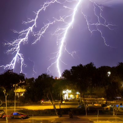
Possible Thundery Outbreaks
When the atmosphere gets all charged up, literally and figuratively, we’re in for some thundery outbreaks. It’s as if the skies are staging a grand theatrical performance, complete with sound effects and light shows. Dark, brooding clouds gather, creating an air of suspense. Then, with a brilliant flash of lightning, followed by the deep rumble of thunder, the drama unfolds.
Read more...
Lyrid Meteor Shower
Get ready for a meteor spectacle! The first spring star rain is on its way, and you won’t want to miss it. On April 21 to 22, we will have a chance to observe the largest meteor shower in the Northern Hemisphere — the Lyrid shower, whose maximum will fall on this night.
Read more...
Heavy Rain at Times
This kind of forecast indicates that periods of intense rainfall are expected intermittently throughout a given time period. It suggests that there will be intervals of heavy rain alternating with periods of lighter rainfall or even temporary breaks in precipitation. These variations in rainfall can be attributed to atmospheric conditions and meteorological phenomena.
Read more...
Patchy Freezing Drizzle
Patchy freezing drizzle is like a whimsical artist’s touch on a winter canvas. It’s not the typical rain or snow, but a light drizzle that freezes upon contact, turning everything it touches into a glistening wonderland. With temperatures hovering just below freezing, often between -5 to 0°C (23 to 32°F), this drizzle creates a delicate layer of ice on roads, trees, and buildings.
Read more...
What Differs Drizzle From Similar Phenomena?
Drizzle is a type of light rainfall characterised by very fine water droplets falling from the sky. It typically occurs when the temperature is above freezing, around 5 to 10 degrees Celsius (41 to 50 degrees Fahrenheit), can also happen at slightly colder or significantly higher temperatures. Light drizzle is common in regions with mild or cool climates, especially during transitional seasons like spring and autumn.
Read more...Cloudy: The Contemplative Sky
On cloudy days, the sky seems to be in a contemplative mood, covered in a thick layer of grayish-white thoughts. It’s as if the sun, usually the life of the party, decided to take a day off and let the clouds have their moment of fame. While the sun takes a nap, hidden behind the clouds, the world seems softer, the edges more blurred.
Read more...
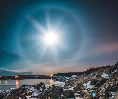
Shining Circle Around the Sun or Moon: What is it?
Sometimes we can see a brightly shining circle around the Sun, the Moon, or even an artificial light source (for example, a lantern). This natural phenomenon is called “halo”. It appears because of the refraction of light in ice crystals in the upper atmosphere at an altitude of 5-10 km.
Read more...